Priene: Hellenistic Grid-Plan Town and Temple of Athena
Priene ancient city in Söke: a grid plan on a hillside, the Temple of Athena inscribed with Alexander's name, and a harbour the Menderes silted up.
The ancient city of Priene lies in the Söke district of Aydın, near Güllübahçe, at the foot of Mount Mykale. It is a small Hellenistic city whose streets cross at right angles, set on the slope in steps; by estimates, between four or five thousand and six thousand people lived there. Above the city rise the columns of the Temple of Athena, known for an inscription bearing the name of Alexander the Great.
What is interesting about Priene is that its plan can still be read. The story of the city and its temple joins Alexander's campaign in Anatolia in 334 BC, the gulf that the Menderes (the ancient Meander) filled with silt, and the question of why the name of Hippodamus can be misleading.
At a glance
- Location: Söke, Aydın; at the foot of Mykale. About 6 km north of the bed of the Menderes of that time; today it is far from the coast, because the gulf filled with silt.
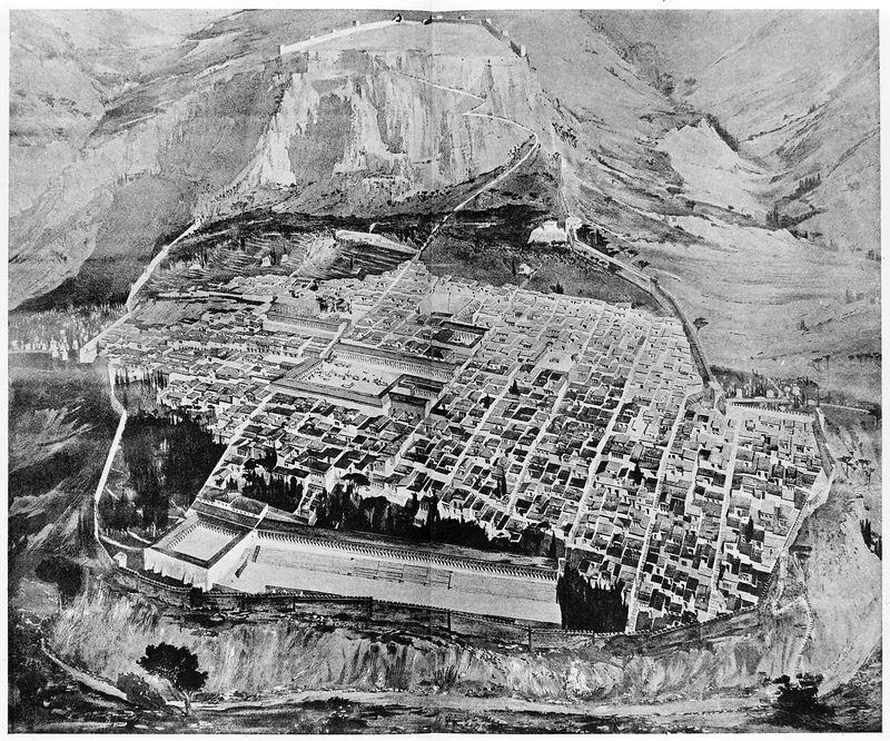
- Plan: Six main east–west streets (about 6 m wide), fifteen cross streets (about 3 m) and about 80 blocks (insulae), each containing eight houses.
- Temple of Athena Polias: Its architect was Pytheos; the dedicatory inscription bearing Alexander's name is today in the British Museum.
- Population: Estimates range from 4,000–5,000 to 6,000.
- Excavations: Theodor Wiegand excavated in 1895–1899 on behalf of the Berlin Museum.
History
How many times was the city moved?
The first foundation of Priene is tied, in legend, to a colony from Thebes (about 1000 BC) and to an Ionian settlement in the 11th century BC. According to Wikipedia, a series of earthquakes about 700 BC moved the city to a spot within 8 km of the place where the 4th-century city would stand; about 500 BC the city was moved once more, to the port of Naulochos. The building of the new city on its present site began about 350 BC in the time of Mausolus, satrap of Caria, and continued after Alexander. Livius too places the refoundation in the 4th century and writes that it was "perhaps at the suggestion of Maussolus".
The grid plan
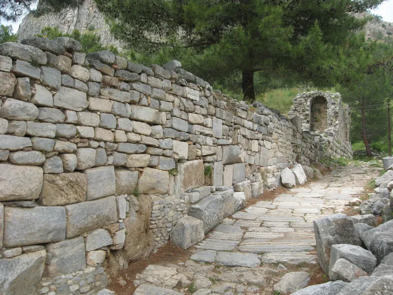
Wikipedia writes that the city was laid out on a rectangular grid: six main east–west streets (about 6 m), fifteen cross streets (about 3 m) and about 80 blocks, each with eight houses. The building material was the local marble of Mykale, with timber for roofs and floors. The walls were 2 m thick, with towers at intervals and three main gates. The city's water supply and drainage systems have survived.
The name "Hippodamian plan", however, can be misleading. Livius writes that after the Persians destroyed Miletus (in 494 BC; this Livius page gives 493) Miletus was rebuilt on a grid plan, that Hippodamus therefore did not invent this design, and that unless he had an extraordinarily long career the name "Hippodamian Plan" is a misnomer; it places Priene in its list of cities founded on Hippodamian principles, but does not tie the city to the person of Hippodamus. The same source writes that Hippodamus was from Miletus. Küre Ansiklopedisi, on the other hand, says that Priene was built on the grid plan of Hippodamus of Miletus; so the naming is a disputed matter in the sources.
Alexander and the Temple of Athena
According to Livius, Alexander dedicated the temple to the city while staying at Priene in the summer of 334 BC during the siege of Miletus; the architect Pytheos is the name who also worked on the Mausoleum at Halicarnassus. Wikipedia's article on Priene writes that Alexander offered to finance the temple on condition that it be dedicated to him, and that the dedication was made in 323 BC; the temple article says that Alexander financed the construction in 334, after his victory at the Granicus. So the date of the dedication (334, 323, or about 330) varies with the source.
The marble block reading "King Alexander dedicated the temple to Athena Polias" was found around the temple in the survey carried out by Richard Pullan on behalf of the Society of Dilettanti in 1868–1869; it measures about 120 × 49.5 cm, is inscribed on both sides, and is in the British Museum under number 1870,0320.88. The other side of the block describes the settlement of land disputes between neighbouring kingdoms after the Persians were driven out. The inscription is dated to about 330 BC.
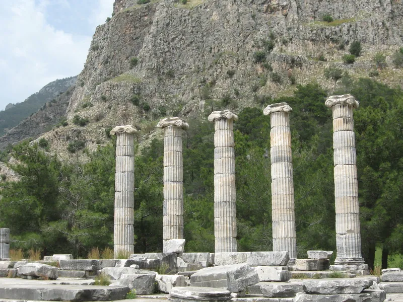
The temple was an Ionic peripteral building on a high terrace, hexastyle (six columns) at front and back; it was built about 350–330 BC, with columns about 11.5 m high. The eastern part and the capitals date from the 4th century BC, while the western parts remained unfinished for at least two centuries. Orophernes, king of Cappadocia, supported the work about 158–156 BC; the cult statue was replaced by a copy of Pheidias's Athena in Athens (acrolithic; about 6.5 m). It was completed in the time of Augustus with Roman support, and Augustus's name was inscribed on the east architrave. The temple fell into ruin through earthquakes in the 7th century; five columns were re-erected from the rubble in 1965–1966.
The closing of the gulf
In the 4th century BC Priene had two harbours on the Gulf of Miletus; the silt of the Menderes filled the gulf. Geoarchaeological findings show that the city lost its harbour and its connection with the sea about the 1st century BC; by AD 300 the Gulf of Miletus, apart from Lake Bafa, was completely filled. Pausanias (2nd century AD) also mentions the silting-up of the bay at Myus. The city nevertheless continued to exist: it prospered in the Roman and Byzantine periods, a synagogue (with a menorah relief) from Late Antiquity is known, and in 1204 the local ruler Sabas Asidenos recognised the Empire of Nicaea, and Byzantine control lasted until the end of the 13th century. After the 1923 population exchange the Turkish population settled in Güllübahçe.
Excavations
According to Wikipedia the Society of Dilettanti sent survey expeditions in 1765 and 1868; the temple article writes that Richard Chandler made a surface survey in 1764–1765 and the society in 1811–1812. Pullan excavated in 1868–1869 and took the finds to the British Museum. Theodor Wiegand worked in 1895–1899; some finds are in the Pergamon Museum in Berlin. According to Küre Ansiklopedisi systematic excavation began in 1895 under the leadership of Carl Humann, and after Humann's death Wiegand continued until 1899. The same source writes that the city was abandoned in the 13th century AD because of inadequate water sources and regional political changes.
What to see
The grid plan and the streets
The paved streets still point to the plan today. An old reconstruction drawing based on the German excavations of 1895–1898 shows a rectangular city at the foot of a steep slope and, at the very top, the acropolis.
The Temple of Athena
Five columns of the temple are standing (re-erected in 1965–1966).
The theatre and the bouleuterion
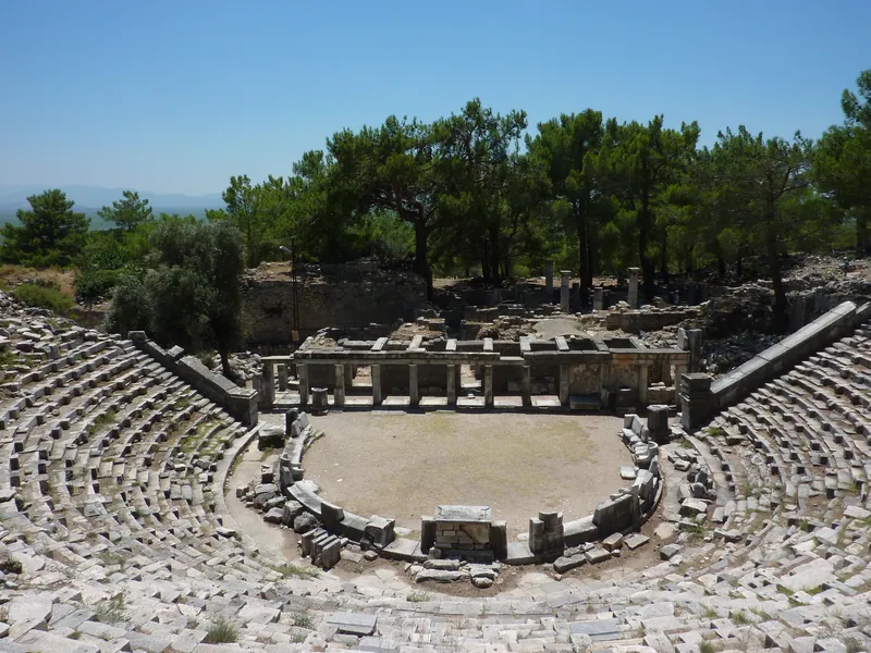
North of the agora are a well-preserved Hellenistic theatre, a bouleuterion and a prytaneion; the bouleuterion was a roofed (timber) space resembling a small theatre. The bouleuterion's capacity is about 640 and there is an altar in the middle; the theatre seated 5,000 and has marble prohedria seats and an altar dedicated to Dionysus.
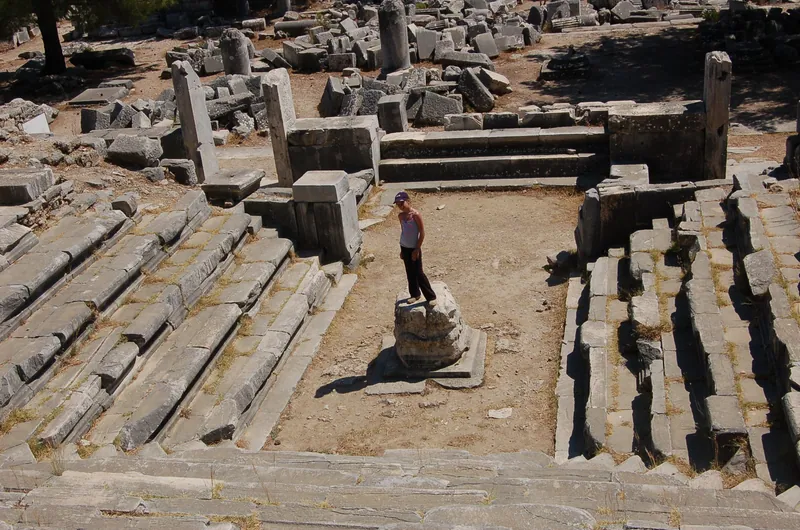
The Upper Gymnasium
The Upper Gymnasium had Roman baths; at the southernmost end of the city there was a large stadium.
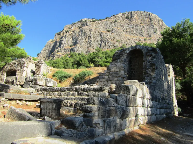
The plain
From the city today one sees the plain of the Menderes; in antiquity this was a gulf of the sea.
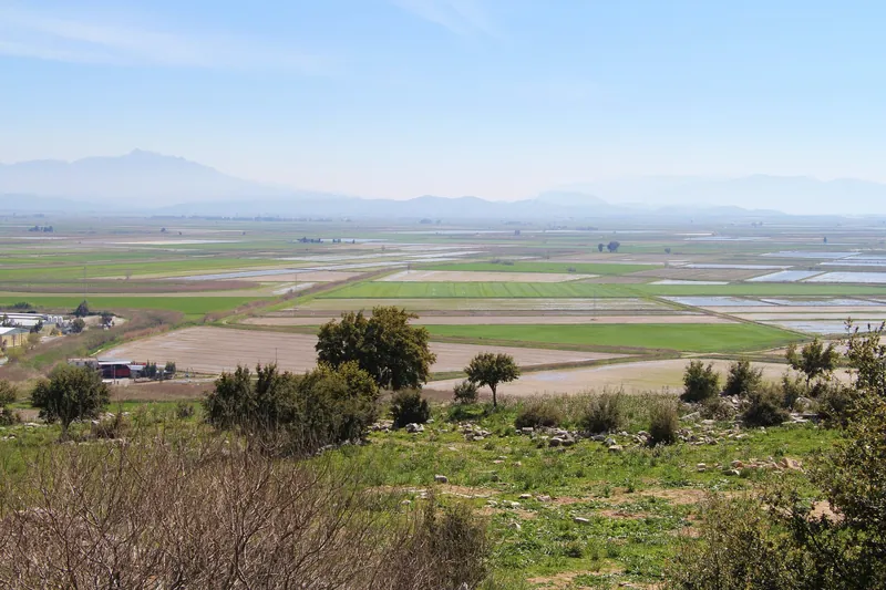
On the route
Priene is the ninth story on the Aegean Coast route; before it come Pigeon Island and the route's Menderes Plain road story. The next stop is Miletus, followed by Didyma.
Frequently asked questions
Did Hippodamus design Priene?
The sources disagree. Küre Ansiklopedisi ties the plan to Hippodamus; Livius says this is disputed: that Hippodamus was from Miletus, that the grid plan was used before him even if it is named after him, and that Miletus was rebuilt on this plan after the Persian destruction (494 BC).
What did Alexander do at Priene?
According to Livius, while staying at Priene during the siege of Miletus in the summer of 334 BC, he dedicated the Temple of Athena Polias to the city; the inscription in the British Museum reads "King Alexander dedicated the temple to Athena Polias".
Why is Priene not on the coast today?
The silt carried by the Menderes filled the Gulf of Miletus. Geoarchaeological findings show that Priene lost its harbour and its connection with the sea about the 1st century BC.
When were excavations carried out at Priene?
Wiegand worked in 1895–1899 on behalf of the Berlin Museum; earlier, in 1868–1869, Pullan excavated the temple here and took the pieces to the British Museum.
Sources
- Wikipedia: Priene
- Wikipedia: Temple of Athena Polias (Priene)
- Wikipedia: Priene inscription of Alexander the Great
- Küre Ansiklopedisi: Priene Antik Kenti (Turkish encyclopaedia; Ancient City of Priene)
- Livius.org: Priene
- Livius.org: Hippodamian plan